

Preconstruction & Sitework Estimating, Raleigh-Durham & the Carolinas
Shape the job before it starts.
Value engineering, LiDAR-verified existing conditions, 2D takeoffs and 3D earthwork models that shape the job before a machine moves.
Preconstruction
Marks partners with project teams before plans are final to shape smarter, more cost-efficient sites.
- Engagement
- Alongside geotechnical engineers, civil designers and builders, before plans are final
- Field Data
- LiDAR drone flights verify existing grades
- Takeoffs
- 2D cut and fill maps that verify balance
- Models
- AGTEK 3D earthwork models
- Bidding
- HCSS HeavyBid, built on production data from our own jobs
- Handoff
- HCSS project management, tied to fleet and accounting
Strategic partners, not just contractors.
Getting in early makes all the difference. We do not wait on final plans to get involved. We prefer to partner early and work alongside geotechnical engineers, civil designers and builders to help shape smarter, more cost-efficient sites.
From optimizing mass grading based on soil conditions and minimizing export, to identifying rock early and adjusting utility depths, we bring real-world experience and tech-forward tools to the table.
Our team is not just estimating. We are value engineering, helping project teams avoid costly surprises, reduce haul off and build in a way that works with the soils instead of against them.


One data chain, from the first flight to the last load
Each step feeds the next, so the numbers that win the job are the numbers that run it.
- 01
LiDAR Drone
Existing ConditionsA LiDAR-equipped drone flies the site to verify existing grades and flag discrepancies before construction.
- 02
2D Takeoffs
Cut & FillDetailed cut and fill maps verify balanced sites, value engineer utility routes and reduce haul off.
- 03
AGTEK 3D Models
Earth Movement3D earthwork models let the whole project team see the dirt move before boots hit the ground.
- 04
HCSS HeavyBid
The BidDetailed bids that combine bid items with real production data from our own jobs.
- 05
HCSS Project Management
The JobOnce awarded, the plan flows into project management, integrated with fleet management and accounting.
Where the savings come from
The cheapest dirt on any job is the dirt nobody has to move twice. These are the levers our team looks at on every site.
Balance the Site
Cut and fill balanced in the model to minimize import, export and haul off.
Less haul offFind Rock Early
Rock identified in preconstruction, not in the middle of a utility run.
Fewer surprisesAdjust Utility Depths
Utility routes and depths value engineered before they are locked in.
Smarter routesWork With the Soils
Mass grading optimized around the soil conditions actually on the site.
Built to the groundVerify Existing Grades
Plan discrepancies caught by LiDAR while they are still inexpensive to fix.
Caught earlyRethink the Walls
Cut and fill rebalanced to value engineer retaining walls out of the design when the site allows it.
Fewer wallsCheck the model against the ground
Drag across any image to compare the plan or the model with what it turned into.
Our takeoffs are not just visual, they are precise. Detailed cut and fill maps verify balanced sites, value engineer utility routes and reduce haul off costs.


AGTEK 3D models help clients see earth movement before boots hit the ground, which means fewer surprises in the field.


The faces behind the numbers
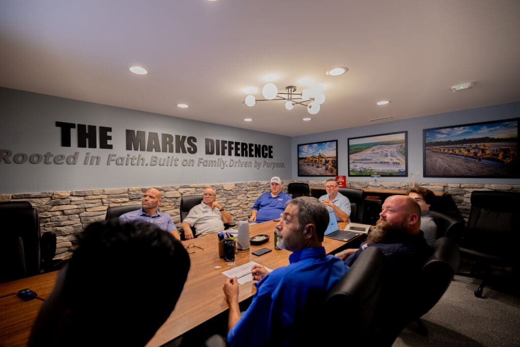
Every number on a Marks bid has a person behind it. Our preconstruction and estimating teams build the takeoffs, price the risk and hand operations a job that can be built the way it was sold.
The budget should still look like the budget at closeout.


Preconstruction FAQ
When should we bring Marks into a project?
As early as possible. Marks prefers to get involved before plans are final, working alongside the geotechnical engineer, civil designer and builder while there is still room to shape the site.
What does the LiDAR drone survey do?
Before construction, a LiDAR-equipped drone flies the site to verify existing grades and identify discrepancies early, while they are still inexpensive to address.
What software does Marks use for takeoffs and bids?
AGTEK for 2D cut and fill takeoffs and 3D earthwork models, HCSS HeavyBid for bids built on production data from Marks jobs, and HCSS project management once a job is awarded.
Can Marks value engineer an existing design?
Yes. Typical opportunities include balancing cut and fill to reduce export, identifying rock early, adjusting utility depths and routes, and rebalancing grades to reduce or eliminate retaining walls.
What kinds of projects does Marks model?
Subdivisions, shopping centers and DOT projects, among others. The same 2D and 3D tools apply to any site with significant earthwork.
Where does Marks provide preconstruction services?
Throughout Greater Raleigh-Durham and the Carolinas, from our headquarters in Wendell, North Carolina.
Bring Marks in before the plans are final.
Share your plans, even early ones. We will show you where the site can be built smarter and what it will take to build it.
